Short Seminars and Webinars
Titles and Abstracts - 45 Minute Presentations
Reaching Across Borders with GIS
Whether you are working across the counter or on the phone with someone dealing with your assessment, CAMA or GIS information, I am sure we have all heard the same thing: "That isn't how it's done in the neighboring county." It gets even more confusing when you are a taxing district, emergency services district or municipality that crosses over one or more county lines. Federal, State, and Local Government have been struggling with this issue for some time now and continue to bump into multiple walls or hurdles that either hinder their progress or stop it altogether. This workshop will review how the 6 counties in the Chicagoland area (DuPage, McHenry, Lake, Cook, Kane and Will Counties, IL) have worked together to come up with a set of standards that will allow them to share their GIS data in a way that is usable by the surrounding jurisdictions.
This presentation will be of primary interest to the GIS users. This presentation will also be of interest to the Assessment and CAMA users who deal with multi-jurisdictional issues and tax districts that cross county boundaries. I am in the midst of trying to get one of the participants to give this workshop with me. Either way, I will bring flash drives to hand out that include the final draft of their standards document along with a link to the website where they discuss more about the process that they used to create their standards so that everyone can take it home and be able to review on their own.
GIS: Building a Strong Foundation
The foundation of a house is important to both the longevity of the building and to its ability to support additions. The same holds true to the building of a Geographic Information System. Standards and uses of GIS have not only changed immensely over the past 10 years but as municipalities and counties are looking at more enterprise solutions, existing and new GIS projects have to be more robust. This workshop will look at some important standards integral to a GIS so its foundation can withstand the tasks that it is being asked to accomplish. It will also review the three most basic methods used to build most Geographic Information Systems, and analyze the shortfalls and benefits of each. The ultimate objective: to give the user a better idea as to how the GIS can be used, updated or modified to better fit their needs.
This presentation will be of interest to the Assessment, CAMA and GIS users to help them better understand how their GIS was created. This knowledge will help them better understand how the steps involved in the creation or conversion of their GIS data dictates how it can be used or added to. This workshop is an updated version of the workshop that was presented at the IAAO Councils and Sections conference in Charleston, South Carolina in 2006.
GIS Fireworks
You are always looking for ways to show off your GIS to decision-makers and the public. In an explosion of color, this session will show you easy examples of how to use your GIS for economic development, assessment, street and road management, re-districting, emergency management, and more.
House of Straw, Sticks, or Brick?
Will your GIS stand up to heavy and long-term use because you've built it on a solid foundation? Or will it fall down because it wasn't built right the first time? This session will review the pros and cons of a variety of data conversion methods.
Free-ware GIS (Session: Data Access)
Free-ware GIS...is there such a thing? This session will review methods that can be employed to reduce the cost of implementing a GIS solution for your business or local government featuring solutions that are free to your staff, citizens, and customers.
Mapping Without a Net: GIS Compilation Strategies
Many local government entities still use outdated, inaccurate, or even non-existent parcel maps. The needs of their user communities often warrant or demand a highly accurate GIS parcel data model, supported by digital orthophotography. In these conditions a scan and warp workflow is not sufficient. This session addresses the requirements and methodology needed to reconstruct a GIS cadastral parcel base from original land records; the "from scratch" approach. Topics include determination and evaluation of source records, orthophotography, parcel compilation methods and philosophies, research issues, recommended GIS data model, and parcel maintenance issues.
GIS Data Integrity - How do I get it?
Performing GIS data conversion right the first time is always best. But what if you inherit a GIS with less than accurate data content or less than complete features? This session will help you review your options to clean up your GIS and get things on the right track.
GIS FUNdamentals
This session introduces the power of GIS as a tool for storing and retrieving large amounts of information. The fundamental elements and data structures of a GIS will be explained, and a demonstration on the utility of this technology to obtain fast, accurate and reliable information will be included. Attendees will also learn how GIS can improve the quality and integrity of their existing information systems.
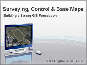
Surveying, Control & Base Maps
Anything that is built to last has a strong foundation. It is no different with building a lasting and strong GIS. The session reviews the different type of surveys, control and base maps that make up a GIS. The good, the bad and the ugly.
Evolution of Maps
Maps are everywhere. They are so prevalent that many of us take them for granted. This fun session reviews the history of maps; from the very first map found on caves to what we use today to help guide us in our many daily tasks. We will also look at the "first GIS" and where and how we are using GIS maps in cars, phones and in our work.